THE

PROPOSAL

VISION


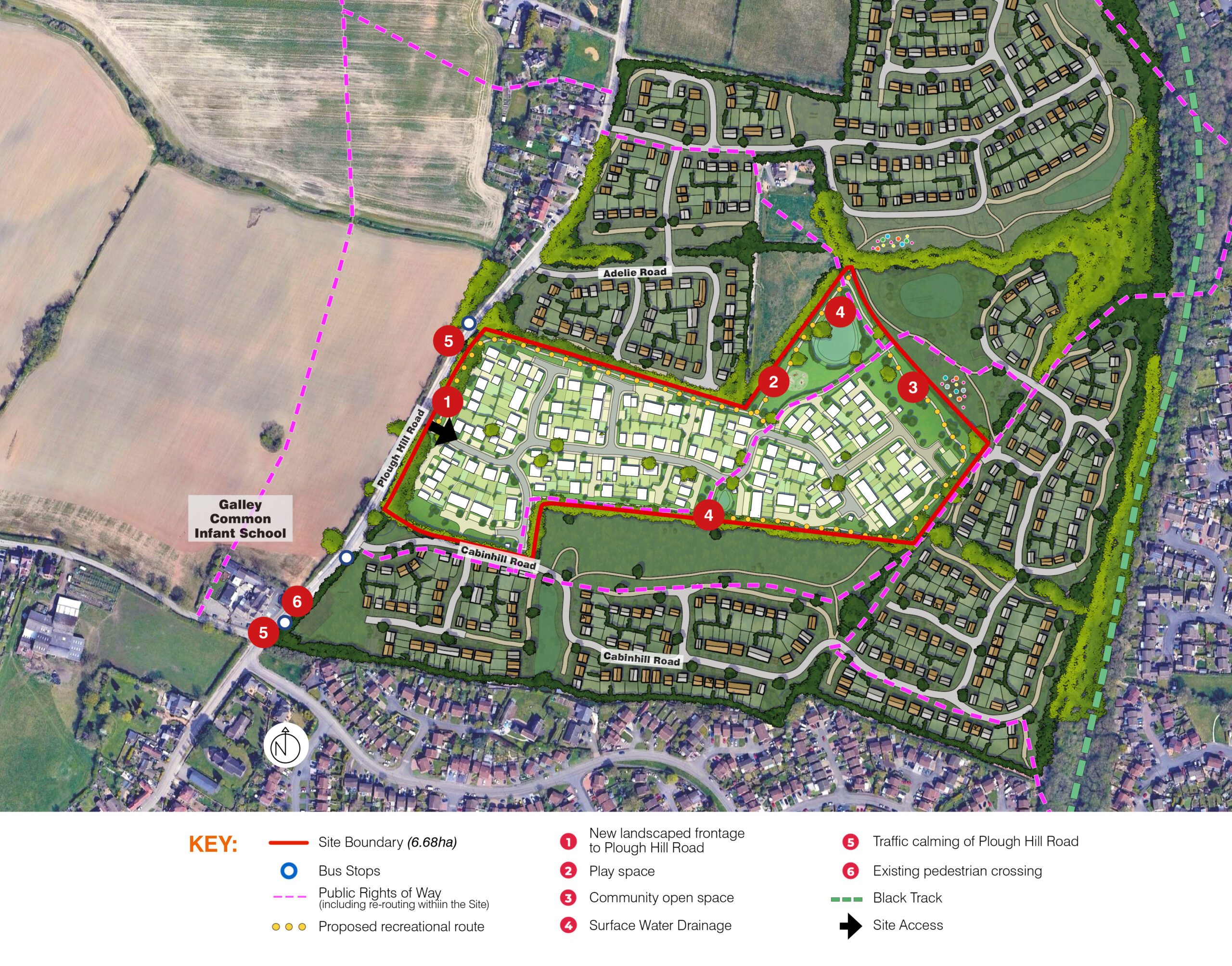
Our vision is to create a sustainable community of 160 homes, centred on walking and cycling and reducing traffic speeds in the vicinity of Galley Common Infant School. It will integrate with existing communities, providing new green spaces, play areas, habitats and attractive recreational routes for the benefit of everyone.
The scheme aspires to create a well-balanced community that combines high-quality living with thoughtful design, enhancing the character of the local area within a safe and attractive environment.

ILLUSTRATIVE MASTERPLAN


KEY OPPORTUNITIES & FEATURES OF THE SCHEME


  • Meeting Local Housing Needs: The development provides 160 high-quality homes, including 25% affordable housing, addressing the Borough’s significant housing shortfall.
  • Enhanced Connectivity: The Site’s unique location offers excellent connectivity to existing neighbourhoods and local amenities, with improved walking and cycling routes that encourage sustainable travel and reduce reliance on cars. A key feature of the Scheme is the introduction of a traffic calming scheme to reinforce a 30mph speed limit around Galley Common Infant School.
  • Sustainable and Landscape-Led Design: The masterplan is landscape-led, integrating green spaces, tree planting, and sustainable drainage systems to enhance biodiversity, manage surface water, and create attractive outdoor spaces for residents.
  • Logical Growth Location: Surrounded by existing development on three sides, the site offers a natural and logical extension of Nuneaton’s urban area without encroaching into the Green Belt or open countryside.
  • Low Environmental Impact: Located in Flood Zone 1, the site has low flood risk, no significant noise or air quality concerns, and no heritage constraints, making it an ideal location for new homes with minimal environmental impact.
  • Economic and Community Benefits: The scheme will support the local economy by creating construction jobs and generating increased demand for local services, enhancing the vibrancy and resilience of the wider community.

BREAKDOWN OF LAND USES


The proposed housing development covers a total site area of 6.7 hectares, of which 35% is set aside for green spaces (2.4 hectares).

4.3 hectares is for the new homes, at a density of circa 37 dwellings per hectare.

PLACEMAKING STRATEGY


GREEN INFRASTRUCTURE STRATEGY


ACCESS AND MOVEMENT STRATEGY


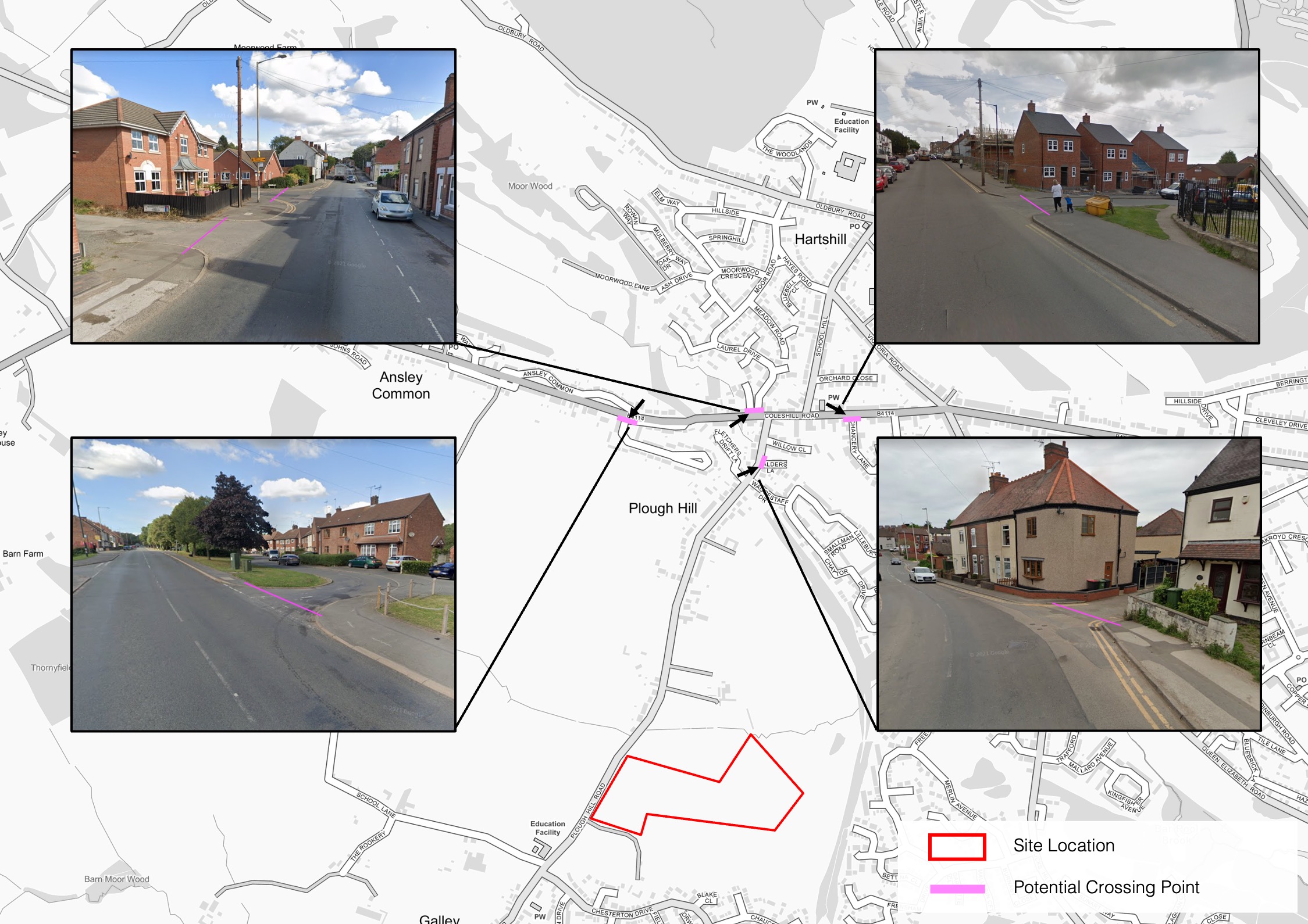
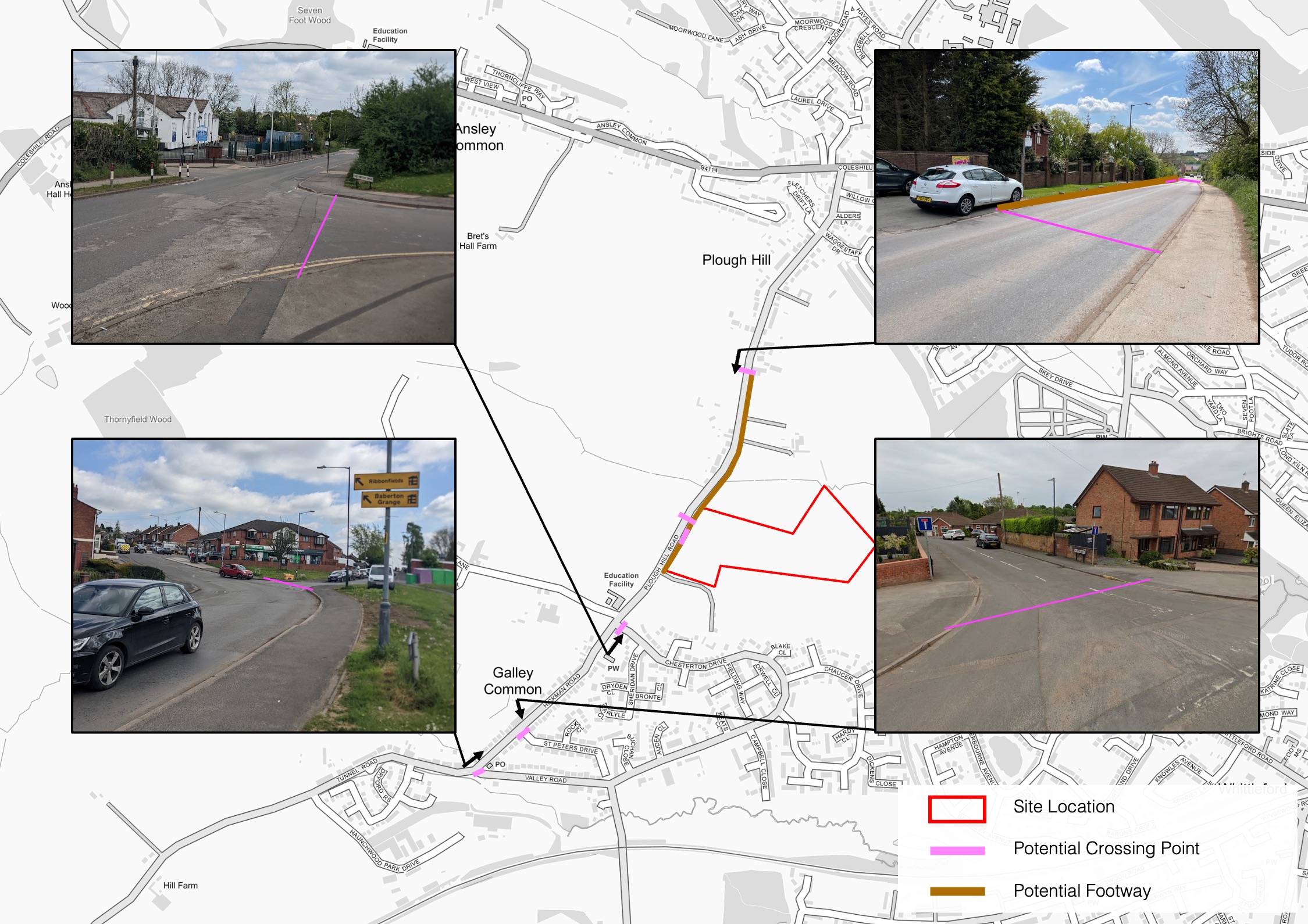
Proposed improvements to walking and cycle routes.

ACCESS AND MOVEMENT STRATEGY


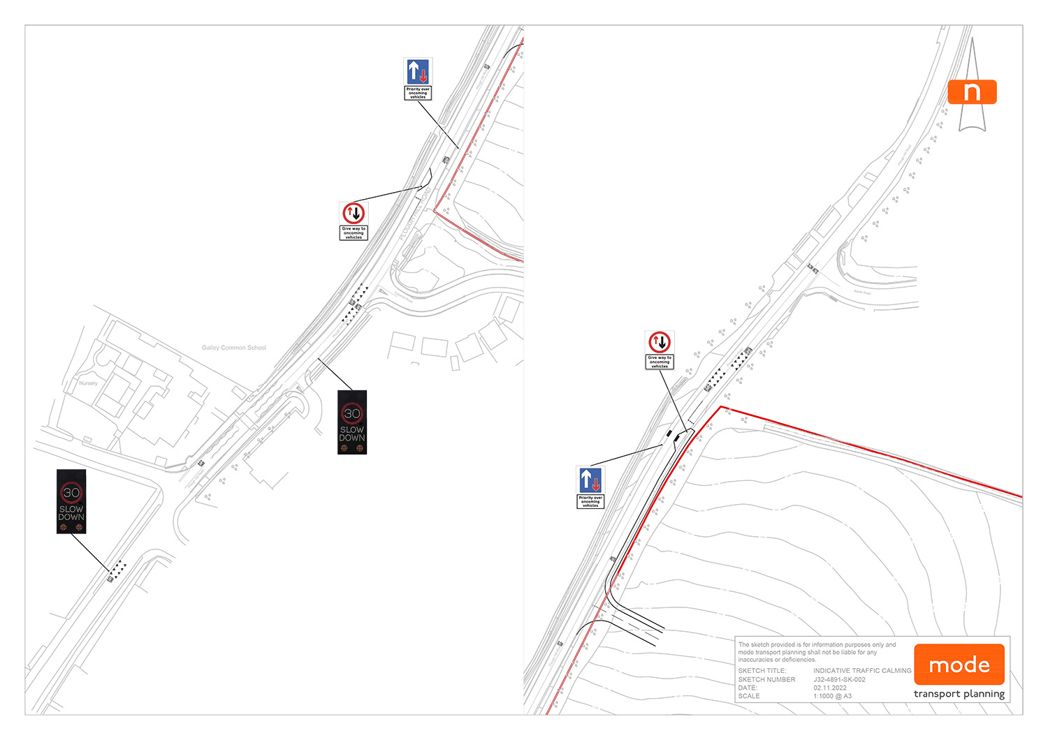
Indicative traffic calming scheme for Plough Hill Road.

ACCESS AND MOVEMENT STRATEGY


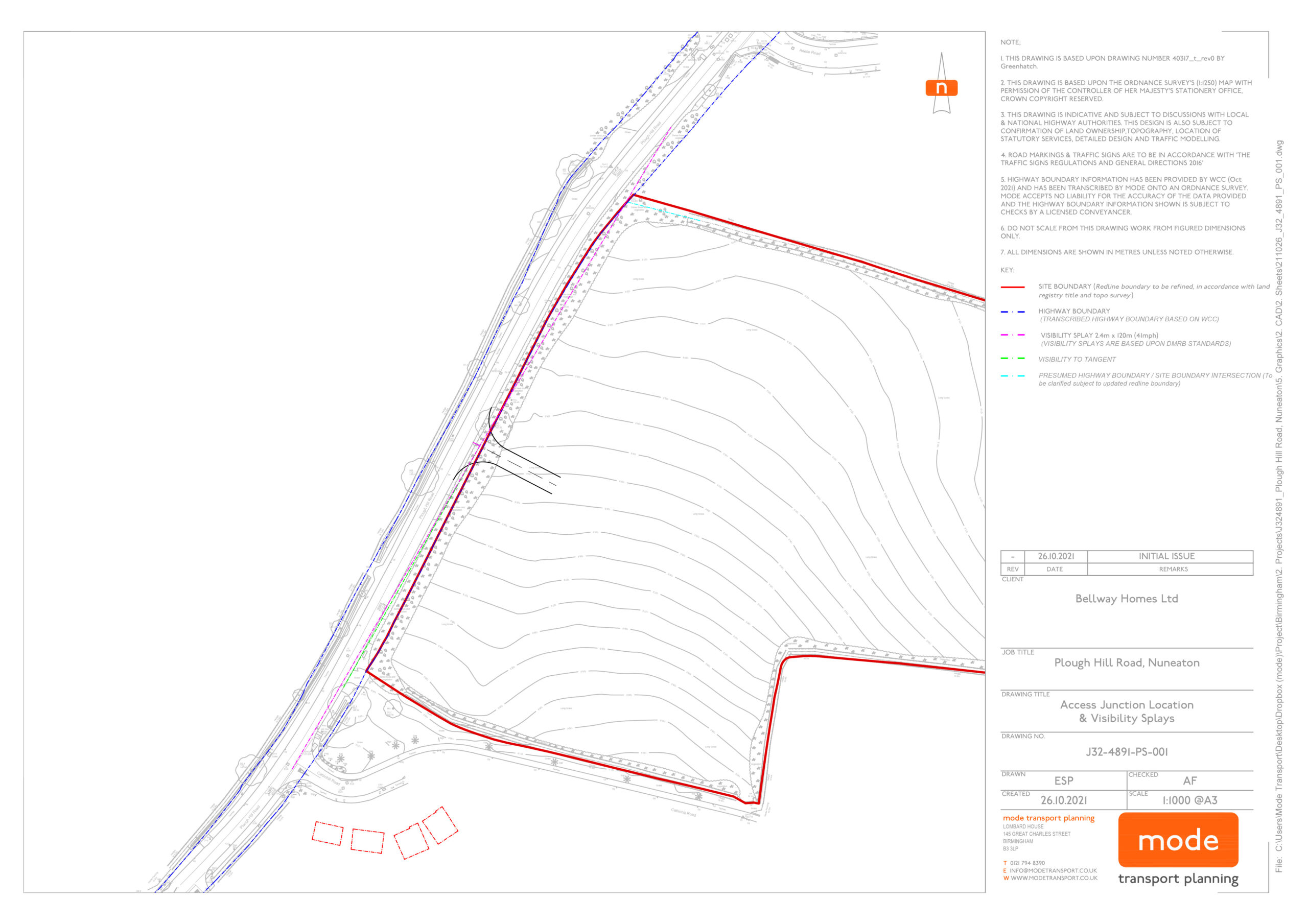
Indicative Access Design.

SUSTAINABILITY STRATEGY


HAVE YOUR SAY